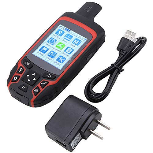
Navigation functions:
1. Outdoor hiking
2. Orienteering
3. Outdoor rescue
4. Looking for campsites
5. Outdoor adventure
6. Cross the desert
7. Looking for water source
8. Navigating along the road
Application:
Agriculture: Acre measurement, length measurement
Forestry: Area calculation, park and garden planning
Geology: Regional water quality survey
Communication: Network planning, base station location
Fishing: Save the coordinate of fishing point
Shop inspection, inflection point coordinates, track recording
Specification:
Satellite system: GPS + beidou
Positioning accuracy: 1m
Positioning time: 45s
Plug type: US plug
Rated voltage: 110VAC
Display: 2.4 inches color LCD
Straight-line navigation: Support
Track navigation: Support
Compass: Support
Coordinate point storage: 1000 records
Data export format: TXT / CSV / GPX / CAD / BMP
Battery capacity: 2500mAh rechargeable lithium battery
Charging method: USB charging
Waterproof grade: IP65
Product size: 15*5.5*2.5cm / 5.9*2.1*1.0in
Package weight: Approx. 387g / 13.6oz
Package list:
1 * Handheld GPS Navigation
1 * Hanging Rope
1 * USB Cable
1 * CD
1 * Plug
1 * User Manual
Product Features
- Multi-functional GPS Navigation Ensures Safety Tourist for You: This Handheld GPS is multiple tools for variety outdoors activities, such as outdoor hiking, orienteering, outdoor rescue, looking for campsites, outdoor adventure, cross the desert, looking for water source, navigating along the road, time-saving tool for you to enjoy a leasure and safety journey
- Widely Applications: This Handheld GPS Navigation has widely applications, it can be applied for agriculture, forestry, geology, communication, fishing and shop inspection, such as acre measurement, length measurement, area calculation, park and garden planning, regional water quality survey, network planning, base station location, save the coordinate of fishing point, inflection point coordinates and track recording
- Updated Version Meets Different needs: This A6 Handheld GPS Navigation fully upgrades and optimizes the operation process, data organization form, satellite navigation location module, system and map navigation, so as to meet the requirements of user acquisition, area measurement, navigation, point finding, track recording and other work in various industries as much as possible
- High-Valued Package: There is a Handheld GPS Navigation, a hanging rope , a usb cable, a cd, a plug and a user manual inclded in the package, no needs to buy additional accssories, you can use them easily with the equipped mannual
- Convenient Charging and Easier Carriage: USB charging and hanging rope offers more convenient operation for you


Comments
Comments are disabled for this post.